Some useful methods to measure the land areas precisely
The measurement of the land should be taken for the following purposes :-
1. Before purchasing
2. While performing stock taking
3. Erecting a boundary wall
4. Dispute with a neighbor over demarcation, etc.
The process is simple for measuring uniform land area like residential plots which are sold through real estate agents and land developers since they contain mostly rectangle or other geometrical shapes. But the process becomes complicated when the area of land is completely unequal in shape or the large tracts of lands are brought.
In this civil engineering article, one will be familiar with some exclusive processes & high-tech solutions which can be applied independently for measuring any land.
The land can be measured with simple geometry, maps and planimeter, GPS, aerial photography, satellite imagery, Google earth, maps and graphs and measuring wheels.
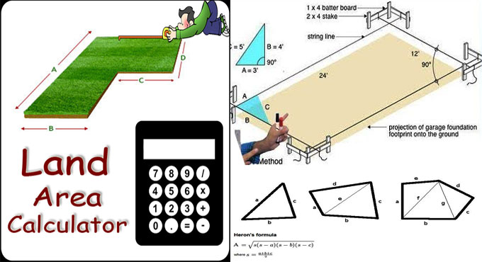
Geometric Method: Under this system, initially, the odd shaped plot is surveyed and blueprinted over graph paper. The area of the plot is then segmented into geometric figures and their areas can be measured with various formulas.
Initially, the biggest size geomatric figure that can be precisely drawn in the map is created, accompanied by tiny shapes, unless the entire space is taken approximately.
All these figures contain their areas which are already measured and then added collectively to provide the total area.
As for instance: Area of Rectangle: Length x Breadth, Area of Square: Length x Length, Area of Triangle: 0.5 x Base x Height, Area of Trapezium: 0.5 x (Length 1 + Length 2) x Height
The above formulas should be applied to determine the perfect area.
Planimeter on Map: It is a small apparatus that can be applied to calculate the areas of a graphically represented planar region. The planimeter can work out all regular and irregular shapes. Just pivot it at any point and then run the end pin all over the perimeter of the area to be measured. It includes a flexible linkage to move devoid of any effort in all directions.
But, it can only be applied when there is a map of the area or an aerial photograph. The planimeter will provide the area measurement in its own scale or square meter and it should be changed to your own unit.
As for instance, if your square is 300 square feet and the planimeter measures it as 1.5 square meter then 1 m2= 200 feet square
Hence, multiplying the final reading of the planimeter in m2 by 2, the reading in square feet will be obtained.
To get more details, click on the following link www.brighthubengineering.com


